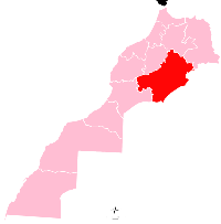
Meski
Appearance
Meski | |
|---|---|
 | |
| Country | |
| Region | Drâa-Tafilalet |
| Province | Errachidia |
| Time zone | UTC+0 (WET) |
| • Summer (DST) | UTC+1 (WEST) |
Meski is a small town in Errachidia Province in the Drâa-Tafilalet region of Morocco. It has fewer than 1,000 inhabitants.[1]
It was the location of a battle between French and Berber forces in the Zaian War on 15 January 1919 where General Joseph-François Poeymirau defeated Sidi Mhand n'Ifrutant.[2]
References
- ^ "Map of Meski, Morocco". Collins Maps. Retrieved 20 December 2012.
- ^ Windrow, Martin (2010). Our Friends Beneath the Sands. London: Phoenix. p. 452. ISBN 978-0-7538-2856-4.
31°53′N 4°16′W / 31.883°N 4.267°W

