Metuje
Appearance
| Metuje | |
|---|---|
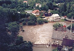
 Metuje River in Nové Město nad Metují during the 1997 floods | |
| Location | |
| Country | Czech Republic |
| Physical characteristics | |
| Source | |
| • location | Broumov Highlands |
| Mouth | |
• location | Labe |
• coordinates | 50°20′18″N 15°55′05″E / 50.3383°N 15.9181°E |
| Length | 78.18 km (48.58 mi) |
| Basin size | 610 km2 (240 sq mi) |
| Discharge | |
| • average | 0.98 m3/s (35 cu ft/s) near estuary |
| Basin features | |
| Progression | Elbe→ North Sea |
The Metuje (Czech pronunciation: [ˈmɛtujɛ]; German: Mettau) is a river in north-eastern Czech Republic. It is a left tributary of the Labe River. It is 78.18 kilometres (48.58 mi) long, and its basin area is about 610 km2, of which 511.37 km2 (197.44 sq mi) in the Czech Republic.[1] The Metuje flows through several towns, including Teplice nad Metují, Náchod and Nové Město nad Metují. The mouth of the Metuje is located in Jaroměř. One of its tributaries called Klikawa comes from Kudowa-Zdrój in Poland.
References
Wikimedia Commons has media related to Metuje.
- ^ "Charakteristiky toků a povodí ČR - Metuje" (in Czech). VÚV TGM. Retrieved 2018-05-08.
