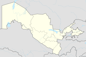
Pop, Uzbekistan
Appearance
Pap | |
|---|---|
Town | |
| Coordinates: 40°52′24.96″N 71°6′32.04″E / 40.8736000°N 71.1089000°E | |
| Country | |
| Region | Namangan Region |
| District | Pap District |
| Town status | 1980 |
| Population (2016) | |
| • Total | 28,000 |
| Time zone | UTC+5 (UZT) |
| Area code | +9986943 |
Pap (Uzbek: Pop/Поп, Russian: Пап) is a town in Namangan Region, Uzbekistan. It is the administrative center of Pap District. This town lies the first on the way to the Fergana valley, on the north-west.
Number of secondary scholls — six (6): № 1, № 8, № 23, № 40, № 65, № 67.
Number of secondary special educational institutions — three (3): boarding school № 11, Medical college, Business college.
Pap town consists of 14 district-units:
- Kelachi
- Khamza
- Shomazor
- Olmazor
- Obod
- Tinchlik
- Khazrati bob
- Uzbekistan
- Sotvoldi Ergashev
- Dustlik
- Pakhtakor
- Alisher Navoi
- Khamid Olimjon
- Abdulla Kakhhar


