Bubaque
Appearance
Bubaque | |
|---|---|
 Port area of Bubaque | |
| Coordinates: 11°17′N 15°50′W / 11.283°N 15.833°W | |
| Country | Guinea-Bissau |
| Region | Bolama Region |
| Sector | Bubaque |
| Area | |
| • Land | 70 km2 (28 sq mi) |
| Population (2009)[1] | |
| • Total | 6,427 |
| Time zone | UTC(UTC-0) (GMT) |
11°17′N 15°50′W / 11.283°N 15.833°W
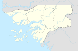
Bubaque is one of the Bijagós Islands in Guinea-Bissau, and is also the name of its main town. The island has a population of 6,427, the town Bubaque 4,299 (2009 census).[1] The area of the island is 75 km², it is 13.6 km long and 8 km wide.
The island is known for its wildlife and is heavily forested. It is also where the Unesco nature reserve headquarters is situated, as well as a museum.[2]
Transportation
The Bubaque airport serves the island. A weekly ferry runs to Bissau from Bubaque's port. All transportation on the island itself is done by motorbike or on foot.
Notable people
- Stefanie Gercke (b. 1941), German-South African writer
- Juvêncio Gomes (b. 1944), fighter for the PAIGC and later mayor of Bissau
References
- ^ a b População por região, sector e localidades por sexo censo 2009, Instituto Nacional de Estatística Guiné-Bissau
- ^ https://www.theguardian.com/travel/2011/may/21/guinea-bissau-beach-holidays Retrieved on July 18, 2012
External links

