Hornnes
Hornnes kommune | |
|---|---|
 View of the local church, Hornnes Church | |
| Coordinates: 58°33′16″N 07°46′23″E / 58.55444°N 7.77306°E | |
| Country | Norway |
| Region | Southern Norway |
| County | Aust-Agder |
| District | Setesdal |
| Municipality ID | NO-0936 |
| Adm. Center | Hornnes |
| Area | |
| • Total | 378 km2 (146 sq mi) |
| Time zone | UTC+01:00 (CET) |
| • Summer (DST) | UTC+02:00 (CEST) |
| Created from | Hornnes og Iveland in 1886 |
| Merged into | Evje og Hornnes in 1960 |
Hornnes is a former municipality in Aust-Agder county, Norway. Hornnes is located within the present-day municipality of Evje og Hornnes in the traditional district of Setesdal. The 378-square-kilometre (146 sq mi) municipality of Hornnes existed from 1886 until 1960. The administrative centre was the village of Hornnes where the Hornnes Church is located.[1]
History
The municipality of Hornnes was created on 1 January 1886 when the municipality of Hornnes og Iveland was divided into two separate municipalities: Hornnes (population: 1,113) and Iveland (population: 1,103). During the 1960s, there were many municipal mergers across Norway due to the work of the Schei Committee. On 1 January 1960, Hornnes was merged with the neighboring municipality of Evje to form a new municipality called Evje og Hornnes (literally "Evje and Hornnes"). Prior to the merger Hornnes had a population of 1,280. On 1 January 1986, the Lislevand farm area (population: 8) in the neighboring Birkenes municipality was transferred to the municipality of Evje og Hornnes.[2]
Name


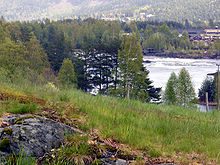
The municipality (originally the parish) of Hornnes is named after an old Hornnes farm (Old Norse: Hornnes), since the first Hornnes Church was built there. The first element is horn which means "horn" and the last element is nes which means "headland". So the meaning of Hornnes is "the headland shaped like a horn", probably referring to the small peninsulas on either side of the river Otra as it enters the lake Breidflå. Historically, the name was spelled Hordnæs.[3]
Attractions
Hornnes Church
Hornnes Church is an octagonal building that was constructed in 1828. Documents show that there was a church in Hornnes as far back as 1327. There are also records in Rome referring to "Ornes i Odralen" (Hornnes Church is part of the Otredal prosti).
Mining
Mining is prevalent throughout the region, and Hornnes is home to the Hornnes Mineralparken. Visitors can tour a mine and learn about the minerals such as quartz and feldspar that are mined there.
Notable residents
- Hartvig Caspar Christie (1893-1959), Norwegian politician
- Torleiv Hannaas (1874-1929), Norwegian philologist, chairman of Noregs Mållag
- Geir Kjetsaa (1937-2008), professor
References
- ^ a b Thorsnæs, Geir, ed. (2015-07-10). "Hornnes". Store norske leksikon (in Norwegian). Kunnskapsforlaget. Retrieved 2017-05-22.
- ^ Jukvam, Dag (1999). "Historisk oversikt over endringer i kommune- og fylkesinndelingen" (PDF) (in Norwegian). Statistisk sentralbyrå.
{{cite journal}}: Cite journal requires|journal=(help) - ^ Rygh, Oluf (1905). Norske gaardnavne: Nedenes amt (in Norwegian) (8 ed.). Kristiania, Norge: W. C. Fabritius & sønners bogtrikkeri. p. 184.
External links
 Aust-Agder travel guide from Wikivoyage


