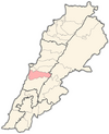
Kaifun
Appearance
Kaifun
كيفون Keyfoun | |
|---|---|
 | |
| Country | |
| Governorate | Mount Lebanon Governorate |
| District | Aley District |
| Time zone | UTC+2 (EET) |
| • Summer (DST) | +3 |
Kaifun (Template:Lang-ar), (also transliterated Kafun, Kaifoun) is a medium-sized village in the Mount Lebanon Governorate, Aley District, in the Republic of Lebanon.[1] It lies slightly south of the village of Souk El Gharb. It has a stunning view of Beirut and the Mediterranean Sea from the western side and a relaxing view of the mountains on the eastern side. Keifoun is around 800 m above sea level and 26 km from central Beirut. Keifoun is known for being the summer recreational and relaxing destination for Beirut residents.

