
Kalopanagiotis
Kalopanagiotis
Καλοπαναγιώτης | |
|---|---|
village | |
 | |
 Kalopanagiotis Location in Cyprus | |
| Coordinates: 34°59′31″N 32°49′45″E / 34.99194°N 32.82917°E | |
| Country | |
| District | Nicosia District |
| Population (2001)[1] | |
| • Total | 287 |
| Time zone | UTC+2 (EET) |
| • Summer (DST) | UTC+3 (EEST) |
Kalopanagiotis (Greek: Καλοπαναγιώτης) is a village in the Nicosia District of Cyprus, located 3 km north of Moutoullas in the Troodos Mountains. It lies in Marathasa Valley. The village and its architecture include cobbled streets and footpaths, chapels and churches. Houses with tiled rooftops, balconies, courtyards and shady vine trees are characteristic of the village.[citation needed] The village is surrounded by the green vegetation of the Setrachos Valley.
In the village there are a number of churches and chapels, such as the churches of Saint Marina and PanayiaTheotokos, the chapels of Saint Andronikos and Saint Athanasia, Saint George, Saint Kyriakos, Archangelos Michael, Saint Sergios and Bachos and Panayia Theoskepasti.
The most notable Byzantine monuments in the area include the monastery of Saint John Lampadisitis, and the Kykkos watermill.
-
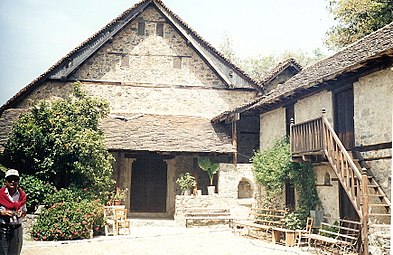 Saint John Lampadisitis
 -
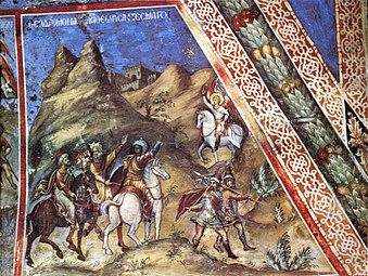
 Christ's way to the Crucifixion
 -
 Three biblical Magi
.jpg)


References

This Cyprus location article is a stub. You can help Wikipedia by expanding it. |