Paciência
Paciência | |
|---|---|
Neighborhood | |
| Coordinates: 22°54′35″S 43°38′15″W / 22.90972°S 43.63750°W | |
| Country | |
| State | Rio de Janeiro (RJ) |
| Municipality/City | Rio de Janeiro |
| Zone | West Zone |
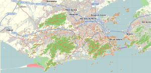
Paciência is a neighborhood in the West Zone of Rio de Janeiro, Brazil.
The region began to grow in 1878 with the inauguration of the Campo Grande railway station, connected to the Estrada de Ferro Central do Brasil (Brazilian Central Railway). It became easier to reach the center of the city quickly, and the region began to develop at a rapid pace. As the neighborhood of Campo Grande is near the neighbourhood of Paciência, all the people from Paciência could use this railway. Nowadays, Paciência has its own Railway called "Paciência Station".
The neighbourhood is also near of Santa Cruz and Sepetiba. There are around 85.000 of inhabitants. There are 25 elementary and high-schools. The neighborhood is very famous by "Paciência Garbage" but unhappily it doesn't work out. Another very famous place is the "Jardim da Saudade Cemetery", that's a big cemetery in Rio de Janeiro.


