Usera
Appearance
Usera | |
|---|---|
 | |
 | |
| Country | Spain |
| Autonomous community | Madrid |
| Municipality | Madrid |
| Area | |
| • Total | 7.70 km2 (2.97 sq mi) |
| Population | 141,189 |
| Madrid district number | 12 |
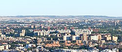
Usera is one of the 21 districts of the city of Madrid, Spain. It is home to significant immigrant communities of Chinese and South American, particularly Bolivian origin.
Geography
Subdivision

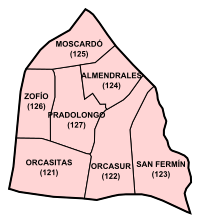
The district is administratively divided into 7 wards (Barrios):
References
External links
![]() Media related to Usera District at Wikimedia Commons
Media related to Usera District at Wikimedia Commons
