
Malieveld
52°05′08″N 4°19′11″E / 52.0855°N 4.3198°E
You can help expand this article with text translated from the corresponding article in Dutch. (June 2019) Click [show] for important translation instructions.
|
| Malieveld | |
|---|---|
 Circus Herman Renz on Malieveld in October 2014 | |
 | |
| Type | Urban open space |
| Location | Haagse Hout, The Hague, Netherlands |
| Coordinates | 52°05′08″N 4°19′11″E / 52.0855°N 4.3198°E |
| Area | 13.9 hectares (34 acres)[1] |
| Managed by | Staatsbosbeheer |
 | |
| Name | Malieveld and surroundings |
| Designated | 27 November 1972 |
Malieveld (Dutch pronunciation: [ˈmaːlivɛlt] , literally "pall-mall field") is a large grass field in the city center of The Hague, Netherlands, located opposite the central train station. The field is widely known in the Netherlands for being the location of many large-scale demonstrations. It is also used for festivals, funfairs, concerts and other big events.[2]
Gallery
-
 Royalist rally in 1918
 -
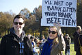
 Student protest in 2011
 -
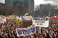
 Occupy protest in 2011
 -
 Veterans' Day in 2015

.jpg)

.jpg)
See also
References
- ^ "Den Haag - Malieveld". Waarneming.nl (in Dutch). Retrieved 17 June 2019.
- ^ "Malieveld". DenHaag.com. Retrieved 17 June 2019.
Wikimedia Commons has media related to Malieveld.