Agia Triada, Cyprus
Appearance
Agia Trias
| |
|---|---|
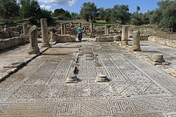
 Ruins of early christian basilica | |
| Coordinates: 35°32′22″N 34°13′10″E / 35.53944°N 34.21944°E | |
| Country (de jure) | |
| • District | Famagusta District |
| Country (de facto) | |
| • District | İskele District |
| Population (2011)[2] | |
| • Total | 614 |
| Climate | Csa |
Agia Trias (Greek: Αγία Τριάς "the Holy Trinity", commonly referred to as Αγία Τριάδα; Turkish: Sipahi “cavalry soldier”, previously Aytriada) is a village on the Karpas Peninsula, 2 kilometres (1.2 mi) east of Gialousa, in Cyprus. It is under the de facto control of Northern Cyprus.
References
- ^ In 1983, the Turkish Republic of Northern Cyprus unilaterally declared independence from the Republic of Cyprus. The de facto state is not recognised by any UN state except Turkey.
- ^ "KKTC 2011 Nüfus ve Konut Sayımı" [TRNC 2011 Population and Housing Census] (PDF) (in Turkish). TRNC State Planning Organization. 6 August 2013. p. 24. Archived from the original (PDF) on 6 November 2013.


