Broshniv-Osada
Broshniv-Osada
Брошнів-Осада | |
|---|---|
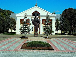
 Monument to Dmytro Vitovsky in front of the Prosvita building | |
| Coordinates: 48°59′38″N 24°11′40″E / 48.99389°N 24.19444°E | |
| Oblast | |
| Raion | Rozhniativ Raion |
| Established | 1890 |
| Government | |
| • Mayor | Nazar Ivaniv |
| Area | |
| • Total | 5.04 km2 (1.95 sq mi) |
| Population (01.01.2018) | |
| • Total | 5,566 |
| • Density | 1,100/km2 (2,900/sq mi) |
| Postal code | 77611-77613 |
| Area code | +380 3474- |


Broshniv-Osada (Ukrainian: Бро́шнів-Оса́да) is an urban-type settlement in Rozhniativ Raion, Ivano-Frankivsk Oblast, western Ukraine. Population: 5,618 (2016 est.)[1].
The first written record of its mention dates from 1890.[2]
References
- ^ "Чисельність наявного населення України (Actual population of Ukraine)" (PDF) (in Ukrainian). State Statistics Service of Ukraine. Retrieved 19 July 2016.
- ^ "Broshniv-Osada settlement: street map, photos". drymba.net. Archived from the original on 25 October 2014. Retrieved 13 June 2015.

