
Röderaue
You can help expand this article with text translated from the corresponding article in German. (August 2012) Click [show] for important translation instructions.
|

Röderaue | |
|---|---|
 Coat of arms | |
Location of Röderaue within Meißen district 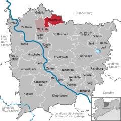 | |
 Röderaue  Röderaue | |
| Coordinates: 51°23′15″N 13°27′30″E / 51.38750°N 13.45833°E | |
| Country | Germany |
| State | Saxony |
| District | Meißen |
| Municipal assoc. | Röderaue-Wülknitz |
| Subdivisions | 5 |
| Government | |
| • Mayor | Lothar Herklotz |
| Area | |
| • Total | 28.94 km2 (11.17 sq mi) |
| Elevation | 104 m (341 ft) |
| Population (2022-12-31)[1] | |
| • Total | 2,562 |
| • Density | 89/km2 (230/sq mi) |
| Time zone | UTC+01:00 (CET) |
| • Summer (DST) | UTC+02:00 (CEST) |
| Postal codes | 01609 |
| Dialling codes | 035263 |
| Vehicle registration | MEI, GRH, RG, RIE |
| Website | www.roederaue.de |
Röderaue is a municipality in the district of Meißen (Meissen), in Saxony, Germany.
Röderaue includes the following subdivisions:
- Frauenhain
- Koselitz
- Pulsen
- Raden
References
- ^ "Einwohnerzahlen nach Gemeinden als Excel-Arbeitsmappe" (XLS) (in German). Statistisches Landesamt des Freistaates Sachsen. 2024.
Towns and municipalities in Meissen (district) | ||
|---|---|---|
 | ||
| International | |
|---|---|
| National | |
This Meissen location article is a stub. You can help Wikipedia by expanding it. |