
Sady Górne
Sady Górne | |
|---|---|
Village | |
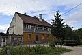
 A house by the road | |
 Sady Górne Location of Sady Górne | |
| Coordinates: 50°53′00″N 16°10′00″E / 50.88333°N 16.16667°E | |
| Country | |
| Voivodeship | Lower Silesian |
| Powiat | Jawor |
| Gmina | Bolków |
| Population | 467 |
Sady Górne [ˈsadɨ ˈɡurnɛ] (German: Ober Baumgarten) is a village in the administrative district of Gmina Bolków, within Jawor County, Lower Silesian Voivodeship, in south-western Poland.[1] Prior to 1945 it was in Germany.
It lies approximately 8 km (5 mi) south-east of Bolków, 19 km (12 mi) south of Jawor, and 67 km (42 mi) south-west of the regional capital Wrocław.
The village has a population of 467.
Gallery
-
 Red roses
 -
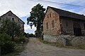 A house and a barn by the road
 -
 A house
 -
 Wooden cross
.jpg)
.jpg)
.jpg)
.jpg)
References
Wikimedia Commons has media related to Sady Górne.
| Town and seat |  | |
|---|---|---|
| Villages | ||
This Jawor County location article is a stub. You can help Wikipedia by expanding it. |