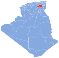
El Hassi, Batna
Appearance
El Hassi
الحاسى | |
|---|---|
 | |
| Country | Algeria |
| Province | Batna |
| District | Aïn Djasser[1] |
| Area | |
| • Total | 60 km2 (20 sq mi) |
| Population (2008[2]) | |
| • Total | 7,990 |
| Time zone | UTC+1 (West Africa Time) |
El Hassi is a town in north-eastern Algeria.
Localities of the commune
The commune of El Hassi is composed of 11 localities [3] :
- Braoula
- Ouled Hassi
- Tamahrit
- El Djabass
- Guabel Messaouda
- Ouled Bouchareb
- Ouled Zerira
- Ouled Yaich
- Ouled Merah
- Ouled Fercha
- Hanfoug
References
- ^ "Décret executif n° 91-306 du 24 août 1991 fixant la liste des communes animées par chaque chef de daïra. 05 - Wilaya de Batna" [List of municipalities animated by each District chief: 05 - Batna Province] (PDF) (in French). Journal officiel de la République Algérienne. 4 September 1991. p. 1295. Retrieved 2019-11-09.
{{cite web}}: CS1 maint: url-status (link) - ^ "Wilaya de Batna: répartition de la population résidente des ménages ordinaires et collectifs, selon la commune de résidence et la dispersion" (PDF) (in French). Retrieved 2019-11-09.
{{cite web}}: CS1 maint: url-status (link). Data from the 2008 General Population and Housing Census on the site of the NOS Algeria. - ^ "Décret n° 84-365, fixant la composition, la consistance et les limites territoriale des communes. Wilaya de Batna" (PDF). Journal officiel de la République Algérienne (67): 1483. 19 December 1984. Retrieved 3 October 2019.
{{cite journal}}: Unknown parameter|name-list-format=ignored (|name-list-style=suggested) (help)
36°11′N 5°27′E / 36.183°N 5.450°E

