Wairoa River (Auckland)

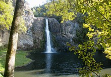
The Wairoa River runs south-southwest from its headwaters in the Hunua Ranges, where it is impounded by the Wairoa Dam to form one of several reservoirs that slake Auckland's thirst. It then turns northward, falling over the Hunua Falls before veering northeastward at Clevedon. It finally winds through an estuary to reach its entrance to the Hauraki Gulf at Pouto Point.
External links
- Photographs of Wairoa River held in Auckland Libraries' heritage collections.
36°56′20″S 175°05′25″E / 36.9389°S 175.0903°E
