Zone 7 of Milan
Appearance
Zona 7 di Milano | |
|---|---|
Zona of Milan | |
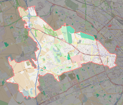
 Location of Zone 7 of Milan | |
 Map of Zone 7 of Milan | |
| Country | |
| Region | Lombardy |
| Province | Milan (MI) |
| Comune | Milan |
| Area | |
• Total | 12.10 sq mi (31.34 km2) |
| Population (2006) | |
• Total | 190,969 |
| Time zone | UTC+1 (CET) |
| • Summer (DST) | UTC+2 (CEST) |
The Zone 7 of Milan (in Italian: Zona 7 di Milano) is one of the 9 administrative zones of Milan, Italy.[1] It is the most extended and the westernmost zone of the city.
Subdivision
The zone includes the following quarters: Assiano, Baggio, Figino, Fopponino, Forze Armate, Harar, La Maddalena, Muggiano, Porta Magenta, Quartiere degli Olmi, Quarto Cagnino, Quinto Romano, San Siro, Valsesia and Vercellese.
Notable places
- San Siro Stadium
- Linterno (ancient monastic grange)
References
- ^ (in Italian) The 9 city councils of Milan (municipal website)
External links
![]() Media related to Municipio 7 (Milan) at Wikimedia Commons
Media related to Municipio 7 (Milan) at Wikimedia Commons
- (in Italian) Zone 7 of Milan (municipal website)
