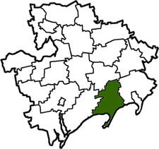
Prymorsk Raion
Appearance
Prymorskyi Raion
Приморський район | |
|---|---|
 | |
| Coordinates: 46°50′5.52″N 36°19′15.58″E / 46.8348667°N 36.3209944°E | |
| Country | |
| Region | Zaporizhia Oblast |
| Established | 1923 |
| Admin. center | Prymorsk |
| Subdivisions | List
|
| Government | |
| • Governor | Oleksandr Onyshko |
| Area | |
| • Total | 1,400 km2 (500 sq mi) |
| Population (2013) | |
| • Total | |
| Time zone | UTC+02:00 (EET) |
| • Summer (DST) | UTC+03:00 (EEST) |
| Postal index | 72100—72151 |
| Area code | +380 6137 |
| Website | http://primorskadmin.org.ua |
Prymorsk Raion (Ukrainian: Приморський район) is one of the 20 raions (districts) of Zaporizhia Oblast in southern Ukraine. The administrative center of the region is the town of Prymorsk. Population: 31,069 (2013 est.)[1].
In October 1930 peasant in the raion rioted for three weeks against forced collectivization by the Soviet authorities.[2][nb 1]
Notes
- ^ Ukraine, as the Ukrainian SSR, was part of the Soviet Union from 1920 until Ukraine declared its independence from the Soviet Union on 24 August 1991.[3]
References
- ^ Чисельність наявного населення України [Actual population of Ukraine] (in Ukrainian). State Statistics Service of Ukraine. Archived from the original on 2014-02-02. Retrieved 21 January 2015.
- ^ (in Ukrainian) IN ZAPOROZHYE REGION WILL ESTABLISH A MEMORIAL SIGN TO ANTIKOLHOSPIN REBELS, Ukrayinska Pravda (10 July 2018)
- ^ A History of Ukraine: The Land and Its Peoples by Paul Robert Magocsi, University of Toronto Press, 2010, ISBN 1442610212 (page 563/564 & 722/723)


