Minsar
This article includes a list of general references, but it lacks sufficient corresponding inline citations. (September 2019) |
Moincêr | |
|---|---|
village | |
 A side street of Moincêr | |
| Coordinates: 31°11′N 80°46′E / 31.18°N 80.76°E | |
| Country | |
| Region | Tibet Autonomous Region |
| Prefecture | Ngari |
| County | Gar |
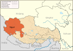
Moincêr, Mencixiang, Menshi or Menze (formerly called Minsar and Missar) is a village in the Tibet Autonomous Region of China. It is located along Route G219, close to the Tirthapuri Monastery in the Ngari Region of Western Tibet. The village is located south-west of Mount Kailash (Mount Ti-se). Moincêr depends on its small coal-mining industry; from which it once produced large amounts of ore from its nearby mines. The village is small and its villagers live depending heavily on yaks for agriculture and trade.

Historically, the town was a Ladkhi enclave in Tibet, established in 1684 Treaty of Tingmosgang. It was possibly used for porterage for the Ladakhi trade caravans to Tibet.[1][2]
References
- ^ Fisher, Margaret W.; Rose, Leo E.; Huttenback, Robert A. (1963), Himalayan Battleground: Sino-Indian Rivalry in Ladakh, Praeger, p. 165 – via Questia
- ^ Mehra, Parshotam (1992), An "agreed" frontier: Ladakh and India's northernmost borders, 1846-1947, Oxford University Press, p. 236: "Minsar (Missar) – Ladakhi enclave in West Tibet close to Lake Manasarowar; during the Dogra-Tibet War (1841-2), the Dogras stored their supplies here."
See also


