Chatterton, Indiana
Appearance
Chatterton, Indiana | |
|---|---|
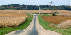
 Looking toward present-day Chatterton | |
| Coordinates: 40°24′13″N 87°14′23″W / 40.40361°N 87.23972°W | |
| Country | United States |
| State | Indiana |
| County | Warren |
| Township | Adams |
| Elevation | 712 ft (217 m) |
| Time zone | UTC-5 (Eastern (EST)) |
| • Summer (DST) | UTC-4 (EDT) |
| ZIP code | 47975 |
| Area code | 765 |
| GNIS feature ID | 432436 |
Chatterton was a small town in Adams Township, Warren County, in the U.S. state of Indiana. It was founded in 1896 and included a school, a general store, and a post office that operated from 1900 to 1906.[2] Though it has since dwindled away completely, the location of the town still persists on county maps, and is cited by the USGS.[3] The mailbox for the single house remaining at the site has "Chatterton" stenciled on it.
Geography
Chatterton was located about 3 miles (4.8 km) south of Pine Village.
References
- ^ "US Board on Geographic Names". United States Geological Survey. October 25, 2007. Retrieved 2016-07-10.
- ^ "Warren County". Jim Forte Postal History. Retrieved July 10, 2016.
- ^ "Chatterton, Indiana". Geographic Names Information System. United States Geological Survey, United States Department of the Interior. Retrieved 2010-08-22.
- Warren County Historical Society. A History of Warren County, Indiana (175th Anniversary Edition) (2002).


