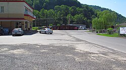
Hurley, Virginia
Appearance
Hurley | |
|---|---|
Unincorporated community | |
 State Route 643 in Hurley | |
| Coordinates: 37°25′8″N 82°1′19″W / 37.41889°N 82.02194°W | |
| Country | United States |
| State | Virginia |
| County | Buchanan |
| Time zone | UTC−5 (Eastern (EST)) |
| • Summer (DST) | UTC−4 (EDT) |
Hurley is an unincorporated community in Buchanan County, Virginia located at the convergence of County Routes 643, 646, 650, and 697, a short distance from the Kentucky and West Virginia state lines.
History
The Hurley post office was established in 1893.[1] The community was probably named for Samuel Robert Hurley, a pioneer settler.[2]
Hurley suffered devastating floods in 2002 which nearly wiped out the town.[3] The recovery efforts resulted in an FBI and IRS investigation into alleged corruption surrounding the use of government funds.[4]
Schools
- Hurley High School
- Hurley Elementary/Middle School
References
- ^ "Buchanan County". Jim Forte Postal History. Retrieved 28 September 2014.
- ^ Tennis, Joe (2004). Southwest Virginia Crossroads: An Almanac of Place Names and Places to See. The Overmountain Press. p. 4. ISBN 978-1-57072-256-1.
- ^ Hurley flood response hits high water mark[permanent dead link]. Emergency Management Update. Virginia Department of Emergency Management, June 2002. Retrieved on 2009-03-18.
- ^ Big Coon Dog lawsuit trees little cash Archived 2012-09-14 at archive.today. Hammack, Laurence. Roanoke Times. June 7, 2008.


