Jump to content

Kolochava

Coordinates: 48°26′12″N 23°44′1″E / 48.43667°N 23.73361°E / 48.43667; 23.73361
From Wikipedia, the free encyclopedia

This is an old revision of this page, as edited by Fixer88 (talk | contribs) at 22:56, 15 February 2020 (typo). The present address (URL) is a permanent link to this revision, which may differ significantly from the current revision.

Kolochava
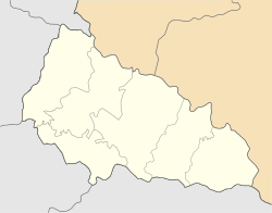
Kolochava is located in Zakarpattia Oblast
Kolochava
Kolochava
Kolochava is located in Ukraine
Kolochava
Kolochava
Coordinates: 48°26′12″N 23°44′1″E / 48.43667°N 23.73361°E / 48.43667; 23.73361
CountryUkraine Ukraine
OblastZakarpattia Oblast
RaionMizhhirya
Population
 (2001)
5,026

Kolochava (Ukrainian: Колочава) is a village in Mizhhirya Raion, Zakarpattia Oblast, Ukraine.

From 1976 to 1992, it had the status of an urban-type settlement, but it was revoked on 6 March 1992.[1]

References