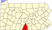
Cove Gap, Pennsylvania
Cove Gap | |
|---|---|
| Country | United States |
| State | Pennsylvania |
| County | Franklin |
| Incorporated | May 30, 1795 |
| Area | |
| • Total | 0.922 sq mi (2.39 km2) |
| Elevation | 239 ft (73 m) |
| Population (2010) | |
| • Total | 64 |
| • Estimate (2016)[2] | 64 |
| Time zone | UTC-5 (EST) |
| • Summer (DST) | UTC-4 (EDT) |
Cove Gap is an unincorporated community in Peters Township in Franklin County, in the U.S. state of Pennsylvania.[3] The community is located along Pennsylvania Route 16 in the western portion of the township near Buchanan's Birthplace State Park.
History
In 1878, Cove Gap had approximately 50 inhabitants.[4] A post office called Cove Gap was established in 1923, and remained in operation until 1938.[5]
Buchanan's Birthplace State Park is located in Cove Gap and honors the 15th President of the United States, James Buchanan, who was born near the site on April 23, 1791.[6]
Demographics
| Census | Pop. | Note | %± |
|---|---|---|---|
| 1860 | 50 | — | |
| 1870 | 107 | 114.0% | |
| 1880 | 100 | −6.5% | |
| 1890 | 109 | 9.0% | |
| 1900 | 20 | −81.7% | |
| 1910 | 59 | 195.0% | |
| 1920 | 69 | 16.9% | |
| 1930 | 60 | −13.0% | |
| 1940 | 68 | 13.3% | |
| 1950 | 201 | 195.6% | |
| 1960 | 156 | −22.4% | |
| 1970 | 79 | −49.4% | |
| 1980 | 78 | −1.3% | |
| 1990 | 69 | −11.5% | |
| 2000 | 68 | −1.4% | |
| 2010 | 64 | −5.9% | |
| 2016 (est.) | 64 | 0.0% |
References
- ^ "2016 U.S. Gazetteer Files". United States Census Bureau. Retrieved Aug 13, 2017.
- ^ "Population and Housing Unit Estimates". Retrieved June 9, 2017.
- ^ U.S. Geological Survey Geographic Names Information System: Cove Gap, Pennsylvania
- ^ M'Cauley, I. H. (1878). Historical Sketch of Franklin County, Pennsylvania. Patriot. p. 207.
- ^ "Franklin County". Jim Forte Postal History. Retrieved 19 June 2017.
- ^ "Cove Gap, Pennsylvania: James Buchanan Birthplace Pyramid". Roadside America. Retrieved 19 June 2017.

