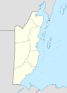
Big Creek Airport (Belize)
Appearance
Big Creek Airport | |||||||||||
|---|---|---|---|---|---|---|---|---|---|---|---|
| Summary | |||||||||||
| Airport type | Public | ||||||||||
| Serves | Big Creek, Belize | ||||||||||
| Elevation AMSL | 22 ft / 7 m | ||||||||||
| Coordinates | 16°31′12″N 88°24′33″W / 16.52000°N 88.40917°W | ||||||||||
| Map | |||||||||||
 | |||||||||||
| Runways | |||||||||||
| |||||||||||
Big Creek Airport (IATA: BGK, ICAO: MZBG) is an airport serving Big Creek, a sea port in the Toledo District of Belize.
The runway is just north of the docks, and parallels Independence Road. East approach and departure are over the water.
The Puerto Barrios VOR-DME (Ident: IOS) is located 48.1 nautical miles (89 km) south-southwest of the airport. The Belize VOR-DME (Ident: BZE) is located 61.5 nautical miles (114 km) north of the runway.[3][4]
Scheduled Service
| Airlines | Destinations |
|---|---|
| Maya Airways | Belize City-International, Dangriga, Punta Gorda |
See also
References
- ^ Airport information for Big Creek Airport at Great Circle Mapper.
- ^ "Big Creek Airport". Google Maps. Google. Retrieved 23 January 2019.
- ^ "Belize VOR". Our Airports. Retrieved 17 January 2019.
- ^ "Puerto Barrios VOR". Our Airports. Retrieved 23 January 2019.
External links
- OpenStreetMap - Big Creek
- OurAirports - Big Creek Airport
- Accident history for BGK at Aviation Safety Network
- Aerodromes in Belize - pdf

