Rahara
Appearance
Rahara
Rath Ara | |
|---|---|
Village | |
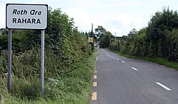
 Rahara on the R362 | |
| Coordinates: 53°31′16″N 8°08′24″W / 53.521°N 8.140°W | |
| Country | Ireland |
| Province | Connacht |
| County | County Roscommon |
| Time zone | UTC+0 (WET) |
| • Summer (DST) | UTC-1 (IST (WEST)) |
Rahara (Irish: Ráth Ara, meaning 'fort of the charioteer') is a village in County Roscommon, Ireland. It lies on the R362 regional road, between Athlone and Athleague about 3 km (1.9 mi) north of the village of Curraghboy.
See also


