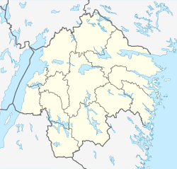
Åtvidaberg
Åtvidaberg | |
|---|---|
 Åtvidaberg | |
| Coordinates: 58°12′N 16°00′E / 58.200°N 16.000°E | |
| Country | Sweden |
| Province | Östergötland |
| County | Östergötland County |
| Municipality | Åtvidaberg Municipality |
| Area | |
| • Total | 5.42 km2 (2.09 sq mi) |
| Population (31 December 2010)[1] | |
| • Total | 6,859 |
| • Density | 1,265/km2 (3,280/sq mi) |
| Time zone | UTC+1 (CET) |
| • Summer (DST) | UTC+2 (CEST) |
Åtvidaberg is a locality and the seat of Åtvidaberg Municipality, Östergötland County, Sweden with 6,859 inhabitants in 2010.[1] The name is a compound word which can be translated as "towards wide mountains" or, jokingly, "ate wide mountains", thanks to the homonym nature of the Swedish word "åt".
History
With the copper finds in the medieval age, a mining district was initiated. The town Åtvidaberg became the seat of a mining industry community.
The town's development was to be directed by the noble family Adelswärd. Through investments in the 19th and early 20th century the town developed into a modern industrial town.
In the 1970s the industry was dominated by Facit, making calculators. It was a major sponsor of the football team Åtvidabergs FF, one of Sweden's strongest team in the 1970s. When Facit went bankrupt in the second half of the 1970s, it led to the downfall and degradation of the team.
At the end of the 19th century almost one third of the population of Åtvidaberg Municipality in Sweden emigrated to Ishpeming, Michigan in the United States as copper mines in the Åtvidaberg area closed down.[9] In 1994 this was commemorated by a plaquette at the Mormorsgruvan mine of Åtvidaberg.
References
- ^ a b c "Tätorternas landareal, folkmängd och invånare per km2 2005 och 2010" (in Swedish). Statistics Sweden. 14 December 2011. Archived from the original on 10 January 2012. Retrieved 10 January 2012.


