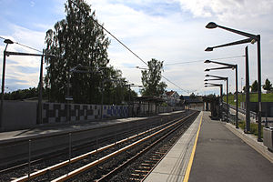
Ringstabekk station
Appearance
 | |||||||||||
| General information | |||||||||||
| Location | Ringstabekk, Bærum Norway | ||||||||||
| Coordinates | 59°54′58″N 10°35′37″E / 59.91611°N 10.59361°E | ||||||||||
| Owned by | Sporveien | ||||||||||
| Operated by | Sporveien T-banen | ||||||||||
| Line(s) | Kolsås Line | ||||||||||
| Distance | 10.2 km from Stortinget | ||||||||||
| Tracks | 2 | ||||||||||
| Construction | |||||||||||
| Structure type | At-grade | ||||||||||
| Parking | Yes | ||||||||||
| Bicycle facilities | Yes | ||||||||||
| Accessible | Yes | ||||||||||
| Other information | |||||||||||
| Fare zone | 1 | ||||||||||
| History | |||||||||||
| Opened | 15 August 2011 | ||||||||||
| Services | |||||||||||
| |||||||||||
Ringstabekk is a station on the Kolsås Line (line 2) on the Oslo Metro system. Located in Bærum, Norway, it is between Bekkestua and Jar, 10.2 km west of Stortinget.
The station opened on 15 August 2011 and replaces the former station with the same name and Tjernsrud as part of the upgrade of the Kolsås Line to metro standard.[1]
The station is located at the section of the line where it is shared with the Lilleaker Line used by the Oslo Tramway. However due to lack of dedicated low-height platforms, trams doesn't stop at this station.
References
External links
![]() Media related to Ringstabekk stasjon at Wikimedia Commons
Media related to Ringstabekk stasjon at Wikimedia Commons

