
Woodlawn, Cleveland County, Arkansas
Woodlawn, Arkansas | |
|---|---|
 Woodlawn | |
| Coordinates: 33°58′00″N 92°02′43″W / 33.96667°N 92.04528°W | |
| Country | United States |
| State | Arkansas |
| County | Cleveland |
| Area | |
| • Total | 2.353 sq mi (6.09 km2) |
| • Land | 2.353 sq mi (6.09 km2) |
| • Water | 0 sq mi (0 km2) |
| Elevation | 259 ft (79 m) |
| Population | |
| • Total | 209 |
| • Density | 89/sq mi (34/km2) |
| Time zone | UTC-6 (Central (CST)) |
| • Summer (DST) | UTC-5 (CDT) |
| Area code | 870 |
| FIPS Code | 05-76690 |
| GNIS feature ID | 2582924[3] |
Woodlawn is a census-designated place in Cleveland County, Arkansas, United States. Its population was 209 as of the 2010 census.[2]
Education
Public education for elementary and secondary students is available from the Woodlawn School District, which leads to graduation from Woodlawn High School.
References
- ^ "US Gazetteer files: 2010, 2000, and 1990". United States Census Bureau. 2011-02-12. Retrieved 2011-04-23.
- ^ a b "Geographic Identifiers: 2010 Demographic Profile Data (G001): Woodlawn CDP, Arkansas". U.S. Census Bureau, American Factfinder. Archived from the original on February 12, 2020. Retrieved June 17, 2014.
- ^ U.S. Geological Survey Geographic Names Information System: Woodlawn, Cleveland County, Arkansas
Municipalities and communities of Cleveland County, Arkansas, United States | ||
|---|---|---|
| Cities | 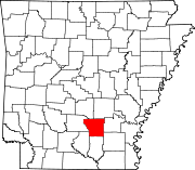 | |
| CDPs | ||
| Unincorporated communities | ||
| Townships |
| |
This Arkansas state location article is a stub. You can help Wikipedia by expanding it. |