Quothquan
| Quothquan | |
|---|---|
 The ruined church at Quothquan | |
Location within South Lanarkshire | |
| OS grid reference | NS994395 |
| Civil parish |
|
| Council area | |
| Lieutenancy area | |
| Country | Scotland |
| Sovereign state | United Kingdom |
| Post town | BIGGAR |
| Postcode district | ML12 |
| Police | Scotland |
| Fire | Scottish |
| Ambulance | Scottish |
| UK Parliament | |
| Scottish Parliament | |
| Website | Quothquan village website |
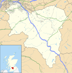
Quothquan (also formerly spelled Couth-Boan; Scottish Gaelic: A’ Choitcheann, pronounced [ə ˈxɔʰtʲçən̪ˠ]) is a village in Libberton parish, South Lanarkshire, Scotland.[1] It is 3+1⁄4 miles (5.2 km) northwest of Biggar, and 7+1⁄2 miles (12.1 km) southeast of Lanark. Quothquan has a village hall near the remains of the graveyard and the ruins of a chapel.
To the southwest is the 1,098-foot (335 m) high Quothquan Law, topped by the remains of a hill fort. The hill comprises two elements, one is an enclosure to the southeast which is around 400 by 230 feet (120 by 70 m). The other is a lower larger annexe to the northwest, with double ramparts and a medial ditch which has mostly been filled in.[2]
The name is derived from Gaelic and translates as "The Common".
The church in the village was paid for in 1903 by Glasgow shipowner Sir Nathaniel Dunlop, who lived nearby.[3]
References
- ^ "A Topographical Dictionary of Scotland (1846), pp. 396-399". Retrieved 13 January 2008.
- ^ "Quothquan Law". Canmore. Historic Environment Scotland. Retrieved 30 January 2019.
- ^ http://www.libbertonquothquan.org.uk/our-history/our-church


