
Marj Al-Ghazal
Marj Al-Ghazal | |
|---|---|
| Arabic transcription(s) | |
| • Arabic | مرج الغزال |
| • Latin | Marj Al-Ghazal (official) |
| State | State of Palestine |
| Governorate | Jericho |
| Government | |
| • Type | Village council |
| Area | |
| • Total | 4,917 dunams (4.917 km2 or 1.898 sq mi) |
| Population (2007) | |
| • Total | 193 |
| • Density | 39/km2 (100/sq mi) |
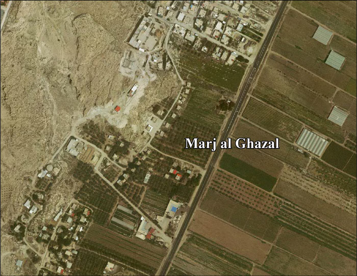
Marj Al-Ghazal (Arabic: مرج الغزال) is a Palestinian village in the Jericho Governorate in the West Bank, located 34.8 kilometers (21.6 mi) north of Jericho. According to the Palestinian Central Bureau of Statistics (PCBS), Marj Al-Ghazal had a population of 193 in the 2007 census.
Location
Marj Al-Ghazal is bordered by the Jordan River to the east. Nearby Palestinian localities include az-Zubaidat to the northeast, Al-Jiftlik to the south and west.[1]
History
In the wake of the 1948 Arab–Israeli War, and after the 1949 Armistice Agreements, Marj al-Ghazal came under Jordanian rule. It was annexed by Jordan in 1950.
Since the Six-Day War in 1967, Marj al-Ghazal has been under Israeli occupation.
In 1970, Israel confiscated 509 dunum of village land in order to construct the Israeli settlement of Argaman.[2]
After 1995 accords, 4% of Marj al-Ghazal’s land was classified as Area B, the remaining 96% as Area C.[3]
In the 2007 census Marj Al-Ghazal had a population of 193 with exactly 92 being males and 101 females. The total number of households was 43 who lived in 50 housing units.[4]
References
- ^ Marj Al-Ghazal Village Profile, ARIJ, 2012, p. 4
- ^ Marj Al-Ghazal Village Profile, ARIJ, 2012, p. 15
- ^ Marj Al-Ghazal Village Profile, ARIJ, 2012, p. 14
- ^ Marj Al-Ghazal Village Profile, ARIJ, 2012, p. 6
External links
- Marj al Ghazal Village (Fact Sheet), Applied Research Institute - Jerusalem (ARIJ)
- Marj al Ghazal Village Profile, ARIJ
- Marj al Ghazal Aerial Photo, ARIJ
- Locality Development Priorities and Needs in Marj al Ghazal, ARIJ
| Cities |  | |
|---|---|---|
| Municipalities | ||
| Villages |
| |
| Refugee camps | ||
| Other | ||
This geography of the State of Palestine article is a stub. You can help Wikipedia by expanding it. |