
State Highway 42 (Maharashtra)
This article needs additional citations for verification. (October 2012) |
.svg) | |
|---|---|
| Ghodbunder Road | |
| Route information | |
| Maintained by MSRDC | |
| Major junctions | |
| From | Kapurbawdi, Thane |
| National Highway 3 National Highway 8 | |
| To | Ghodbunder, Thane |
| Location | |
| Country | India |
| State | Maharashtra |
| Districts | Thane |
| Highway system | |
| State Highways in Maharashtra | |
State Highway 42, commonly referred to as Ghodbunder Road or G.B. Road, runs entirely through the district of Thane. It is one of the major roads leading out of Thane city and connects to the Eastern Express Highway, becoming National Highway 3. It also connects to the Western Express Highway to become National Highway 8 at Ghodbunder leading to Gujarat.
General information
It is approximately 20 km long and links the two main arterial roads of Mumbai, the Eastern Express Highway and the Western Express Highway. The junction where it connects the Eastern Express Highway at Majiwada. The Kapurbawdi bridge has been constructed to ease the traffic congestion.[1] It is tolled by the MSRDC.[2] This road skirts the northern boundary of Salsette Island providing scenic views of the Yeoor hills and the Thane creek.

G.B. Road cuts across dense forests which form part of the Sanjay Gandhi National Park. It also skirts the Vasai Creek for most of its route and overlooks the forest from across the creek. In spite of development encroaching on the forest, much of flora and fauna continue to survive and prosper. Ghodbunder is lined with numerous historical monuments like the Ghodbunder Fort.[citation needed]
Major junctions
The following roads either emanate from it or are crossed by it. This list has been separated by district and talukas for easy reading.
| State | District | Taluka | Distance | Location of Junction | Junction |
|---|---|---|---|---|---|
| Maharashtra | Thane | Thane | 0 km (0 mi) | Majiwada[3] | National Highway 3 |
| 104 km (65 mi) | Ghodbunder[3] | National Highway 8 |
Gallery
-
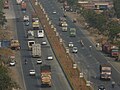 Ghodbunder Road
 -
 Another View along Ghodbunder Road
 -
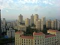 Hiranandani Estate along Ghodbunder Road
 -
 Scenic View along Ghodbunder Road
 -
 State Highway 42 Shield Marker near Ovale village


See also
References
- ^ "dna exclusive: 767-metre-long Kapurbawdi flyover opening on Nov 15 in Mumbai". dna. 26 October 2013. Retrieved 21 January 2019.
- ^ Tripathi, Vedika (10 November 2008). "Ghodbunder Road toll naka gives chocolates, not change". Mid Day. Mumbai. Retrieved 24 May 2015.
- ^ a b "National Highway 3 intersection with State Highway 10 at Malegaon Taluka". Mahapwd.com. Retrieved 22 October 2012. [dead link]