Swingfield
Appearance
| Swingfield | |
|---|---|
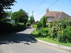
 A street of Swingfield | |
Location within Kent | |
| Population | 1,227 (2011)[1] |
| District | |
| Shire county | |
| Region | |
| Country | England |
| Sovereign state | United Kingdom |
| Post town | Dover |
| Postcode district | CT15 |
| Police | Kent |
| Fire | Kent |
| Ambulance | South East Coast |
| UK Parliament | |
Swingfield is a village and civil parish in the district of Folkestone and Hythe[2] in Kent, England. The parish includes the settlements of Densole and Selsted.
The village is located approximately 5 miles north of Folkestone on the North Downs. Amenities include the St Peter's Church and Swingfield Preceptory.
References
- ^ "Civil Parish population 2011". Retrieved 1 April 2017.
- ^ Ordnance Survey linked data
External links
![]() Media related to Swingfield at Wikimedia Commons
Media related to Swingfield at Wikimedia Commons


