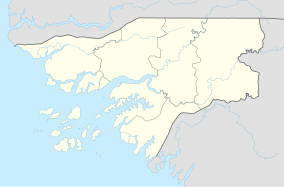
João Vieira and Poilão Marine National Park
Appearance
| João Vieira-Poilão Islands Marine National Park | |
|---|---|
| Coordinates | 10°58′N 15°41′W / 10.97°N 15.69°W |
| Area | 495 km2 (191 sq mi) |
| Created | 2000 |
The João Vieira-Poilão Islands Marine National Park (Template:Lang-pt) is a national park in Guinea-Bissau. It was established in August 2000.[1] It covers 495 km²,[2] and includes the uninhabited islands João Vieira, Cavalos, Meio and Poilão, in the southeastern part of the Bijagós Archipelago.[1] The beaches of the islands are frequented by the sea turtle species Chelonia mydas, Eretmochelys imbricata and Lepidochelys olivacea.[1]
References
- ^ a b c Quadro nacional da biotecnologia e biosegurança da Guiné-Bissau, March 2008, p. 33
- ^ World Database on Protected Areas

