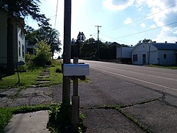
Alderley, Wisconsin
Appearance
Alderley, Wisconsin | |
|---|---|
 County Road O is the primary and sole modern-day
thoroughfare for the small hamlet. | |
| Coordinates: 43°13′03″N 88°26′59″W / 43.21750°N 88.44972°W | |
| Country | |
| State | |
| County | Dodge County |
| Town | Ashippun |
| Elevation | 290 m (951 ft) |
| Time zone | UTC-6 (Central (CST)) |
| • Summer (DST) | UTC-5 (CDT) |
| Area code | 920 |
| GNIS feature ID | 1560746[1] |
Alderley is an unincorporated community located in the town of Ashippun, Dodge County, Wisconsin, United States.[1][2] Alderley is located on Highway O approximately 7 miles (11 km) north of Stone Bank, 3 miles (5 km) north of the unincorporated community of Mapleton, and 3 miles (5 km) east of Ashippun. The community was named by early settlers for Alderley Edge, England.[3]
Notes
- ^ a b "Alderley". Geographic Names Information System. United States Geological Survey, United States Department of the Interior.
- ^ http://wisconsin.hometownlocator.com/wi/dodge/alderley.cfm
- ^ Callary, Edward. Place Names of Wisconsin. Madison, WI: University of Wisconsin Press. p. 6. ISBN 978-0-299-30964-0.


