Partyzanski District
Appearance
Partyzanski (Партызанскі) | |
|---|---|
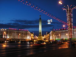
 Victory Square | |
|
Coat of arms of Partyzanski (Партызанскі) Coat of arms | |
 | |
| Country | |
| Voblast | |
| Municipality | |
| Area | |
| • Total | 646 km2 (249 sq mi) |
| Population (2009) | 97,592 |
| • Density | 4,436/km2 (11,490/sq mi) |
| Website | Official website |
Partyzanski District (Template:Lang-be, Russian: Партизанский) is an administrative subdivision of the city of Minsk, Belarus. It was named after the Soviet partisans and is the lesser populated district of the city.[1]
Geography
The district is situated in the central-eastern area of the city and borders Centraĺny, Saviecki, Pieršamajski, Zavodski and Lieninski districts.
Transport
Partyzanski is served by the subway and tram networks. It is also crossed by the beltway "MKAD".
See also
References
- ^ (in Russian) Partizansky Raion Archived 2005-11-02 at the Wayback Machine, Minsk administration website
External links
- (in Russian) Partyzanski District official website
