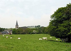
Gesves
Gesves | |
|---|---|
 | |
| Coordinates: 50°24′N 05°04′E / 50.400°N 5.067°E | |
| Country | |
| Community | French Community |
| Region | Wallonia |
| Province | Namur |
| Arrondissement | Namur |
| Government | |
| • Mayor | José Paulet (GEM) |
| • Governing party/ies | GEM, ICG |
| Area | |
| • Total | 65.03 km2 (25.11 sq mi) |
| Population (2018-01-01)[1] | |
| • Total | 7,210 |
| • Density | 110/km2 (290/sq mi) |
| Postal codes | 5340 |
| NIS code | 92054 |
| Area codes | 083 |
| Website | www.gesves.be |
Gesves (French: [ʒɛv]; Walloon: Djeve) is a Walloon municipality located in the Belgian province of Namur. This municipality contains the town of Gesves, as well as the villages of Faulx-Les-Tombes, Haltinne, Mozet, and Sorée. It also includes the hamlets of Gramptinne, Goyet, Haut-Bois, and Strud.
On 1 January 2006 the municipality had 6,321 inhabitants. The total area is 64.92 km², giving a population density of 97 inhabitants per km². On 1 December 2019, the population had grown to 7,246 inhabitants (3,612 men and 3,634 women), representing a growth of 14.63% over the course of 13 years.

See also
Strudiella devonica is an incomplete possible insect fossil, the first complete Late Devonian insect, probably terrestrial. It was recovered in the Strud environment from the Bois des Mouches Formation, Upper Famennian.
References
- ^ "Wettelijke Bevolking per gemeente op 1 januari 2018". Statbel. Retrieved 9 March 2019.
External links
 Media related to Gesves at Wikimedia Commons
- Official website (in French)
- Gesves.com portal (in French)


