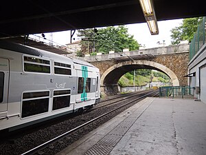
Fontenay-sous-Bois station
| RER station | |||||||||||
 Tracks in Fontenay-sous-Bois station | |||||||||||
| General information | |||||||||||
| Owned by | |||||||||||
| Line(s) | Lua error: expandTemplate: template "RER color" does not exist. | ||||||||||
| Other information | |||||||||||
| Station code | 8775811 | ||||||||||
| Fare zone | 3 | ||||||||||
| History | |||||||||||
| Opened | 1969 | ||||||||||
| Services | |||||||||||
| |||||||||||
Fontenay-sous-Bois is a railway station on RER train network in Fontenay-sous-Bois, Val-de-Marne, France.
History
Fontenay-sous-Bois station used to be served by the Bastille railway line (Paris Bastille – Marles-en-Brie), which has been running from 1859 to 1969.[1] It is now served by RER line A.
Transport
Train
The station is served by a train every 10 minutes at off-peak time in both directions. That frequency is increased during peak hours, with up to 12 trains an hour, and falls to 1 train every 15 minutes at night.[2]
Bus
RATP buses serve the station:[3]
- Line 124 from Val de Fontenay to Château de Vincennes
- Line 210 from Villiers-sur-Marne to Château de Vincennes
- Line 524, a shuttle serving only Fontenay-sous-Bois
Traffic
The number of people entering the station in 2014 was 2,469,377.[4]
References
- ^ "Histoire locale de Fontenay-sous-Bois". fontenayplateau.net. Retrieved 2016-02-10.
- ^ "RER Fontenay-sous-Bois - Evous". www.evous.fr. Retrieved 2016-02-10.
- ^ "Map of sector 10 (eastern Paris) of RATP bus network". www.ratp.fr. Retrieved 2016-02-10.
- ^ "Open Data RATP — Trafic annuel entrant par station du réseau ferré 2014". data.ratp.fr. Retrieved 2016-02-10.
