
Gundlupet
Gundlupet
Gundlupete | |
|---|---|
town | |
| Manu BM | |
 Gundlupet Location in Karnataka, India | |
| Coordinates: 11°48′N 76°41′E / 11.8°N 76.68°E | |
| Country | |
| State | Karnataka |
| District | Chamarajanagar |
| Government | |
| • Type | Gundlupet Town Municipal Council (TMC) |
| • Body | Municipality |
| Area | |
| • Total | 4.22 km2 (1.63 sq mi) |
| Elevation | 816 m (2,677 ft) |
| Population (2018) | |
| • Total | 26,368 |
| Languages | |
| • Official | Kannada |
| Time zone | UTC+5:30 (IST) |
| PIN | 571111 |
| Telephone code | 08229 |
| Vehicle registration | KA-10 |
| Website | www |

Gundlupet or Gundlupete in Kannada is a town in the Chamarajanagar district of the Indian also called as Flower pot of Karnataka state of Karnataka. This small town is about 60 km from the Mysore-Ooty / Mysore-Calicut NH 766 highway and about 200 km from Bangalore, the state capital. Gundlupet is the last town in Karnataka en route to Ooty, Wayanad, Kozhikode, situated very close to Tamil Nadu and Kerala state borders. National Highway -181 ( NH-181 ) starts from Gundlupete and ends in Nagapattinam in Tamil Nadu via Ooty and Coimbatore.
The Bandipur National Park Forest Office is 17 km from Gundlupet. Previously this town was known as "Vijayapura" which got its name due presence of historical Vijayanarayana temple.
Geography
Gundlupet is located at 11°48′N 76°41′E / 11.8°N 76.68°E.[1] It has an average elevation of 816 metres (2677 feet).
Demographics
Agriculture
Main crops are jowar, ragi, sugar cane, turmeric, onion and banana. It is a fairly dry region on the rain-shadow side of the Western Ghats with an average annual rainfall of about 600 mm (almost all of it falling during the monsoon months of July through October. The natural vegetation of the area is Dry Thorn Forest, as can be seen in the nearby reserve forests on the boundary of Bandipur National Park.
Tourist places near by
1. Himavad Gopalswamy hills (20 km from Gundlupet)
2. Bandipur National Park (24 km from Gundlupet)
3, Huluganamuradi Venkataramana betta (26 km from Gundlupet)
4. Paarvati Betta (10 km from Gundlupet)
5. Terakanabi and Triyambakpura temples 12 km from gundlupet.
6. Narasamangala shiva temple 7 km from terkanambi.
7. Manchalli cave temple 12 km from gundlupet
8. Padaguru lingayth math (or Adavi Math Padagur). 11 km from gundlupet.
9. Yeriyur Bisilu basappa temple
10. Shri Shasana Basaveshvara temple in Bommanahalli 22km from Gundlupet
Image gallery
-
 Bus Station
 -
 NH 766 view from Gundalpet to Wayanad
 -
 D.B.G.C
 -
 Mysore Road with sanju
 -
 Karate School
 -
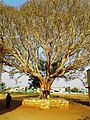 Tree Worship
 -
 Gundlupet Lunch
 -
 St.Johns School
 -
 Bandipur Tiger Reserve
 -
 Vijayanarayana swamy temple
 -
 Gundlupet - Ooty road


.jpg)

