
Țaga
Țaga | |
|---|---|
 Location in Cluj County | |
 Țaga Location in Romania | |
| Coordinates: 46°56′44.52″N 24°3′33.84″E / 46.9457000°N 24.0594000°E | |
| Country | Romania |
| County | Cluj |
| Subdivisions | Năsal, Sântioana, Sântejude, Sântejude-Vale, Țaga |
| Government | |
| • Mayor | Romulus Mârza (since 2004) |
| Population (2021-12-01)[1] | 1,588 |
| Time zone | EET/EEST (UTC+2/+3) |
| Vehicle reg. | CJ |
| Website | www |
Țaga (Hungarian: Cege; German: Zegen) is a commune in Cluj County, Transylvania, Romania. It is composed of five villages: Năsal (Noszoly), Sântejude (Vasasszentegyed), Sântejude-Vale (Vasasszentegyedi völgy), Sântioana (Vasasszentiván) and Țaga.
Demographics
According to the census from 2002 there was a total population of 2,162 people living in this commune. Of this population, 91.67% are ethnic Romanians, 6.15% are ethnic Hungarians and 2.12% ethnic Romani.[2]
References
- Atlasul localităților județului Cluj (Cluj County Localities Atlas), Suncart Publishing House, Cluj-Napoca, ISBN 973-86430-0-7
External links
Wikimedia Commons has media related to Țaga, Cluj.
- (in Romanian) "Primăria Țaga"
-
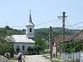 Church (Țaga)
 -
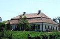
 Traditional house (Țaga)
 -
 Wass Castle (Țaga)
 -
 Reformed church, 15th century (Năsal)
 -
 Wooden church, 1804 (Năsal)
 -
 Reformed church (Sântejude)
 -
 Wooden church (Sântejude)


.JPG)


This Cluj County location article is a stub. You can help Wikipedia by expanding it. |