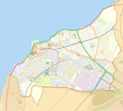
Bare, Morecambe
| Bare | |
|---|---|
 Beach and promenade | |
Location within Lancashire | |
| Population | 4,067 (2011) |
| OS grid reference | SD452647 |
| Civil parish | |
| District | |
| Shire county | |
| Region | |
| Country | England |
| Sovereign state | United Kingdom |
| Post town | MORECAMBE |
| Postcode district | LA4 |
| Dialling code | 01524 |
| Police | Lancashire |
| Fire | Lancashire |
| Ambulance | North West |
| UK Parliament | |

Bare is a suburb of and electoral ward in Morecambe, within the City of Lancaster district in Lancashire, England. The population of the ward as taken at the Census 2011 was 4,067.[1] Bare has a high street (Princes Crescent), and a railway station connecting it to Morecambe and Lancaster. Its name probably came from Anglo-Saxon bearu meaning "grove".
Bare Hall is a Grade II listed building built around 1830 by the Lodge family[2]
References
- ^ "Ward population 2011". Retrieved 7 June 2015.
- ^ http://www.britishlistedbuildings.co.uk/en-391808-bare-hall-morecambe-lancashire
External links
Wikimedia Commons has media related to Bare, Lancashire.
- 1953-1955 Ordnance Survey map showing Bare (on the north edge)


