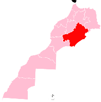
Skoura
Appearance
Skoura
سكورة | |
|---|---|
Town | |
 | |
| Country | |
| Region | Drâa-Tafilalet |
| Province | Ouarzazate Province |
| Population (2004) | |
| • Total | 2,808 |
| Time zone | UTC+0 (WET) |
| • Summer (DST) | UTC+1 (WEST) |
Skoura (Arabic: سكورة) is a town in Ouarzazate Province, Drâa-Tafilalet, Morocco. According to the 2004 census it had a population of 2,808.[1] Skoura is a fertile oasis lined with immense palm groves. The Kasbah Amerhidil is part of Skoura palm grove alongside more.
Skoura is also the name of a Geological Basin.[2]
References
- ^ "World Gazetteer". Archived from the original on 2012-09-18.
- ^ Marinheiro, J., Mateus, O., Alaoui, A., Amani, F., Nami, M., & Ribeiro, C. (2014). New Quaternary fossil sites from the Middle Atlas of Morocco. Comunicações Geológicas, 101(Especial I), 485-488.
31°03′38″N 6°33′20″W / 31.06056°N 6.55556°W


