Tamlouka
Appearance
Tamlouka | |
|---|---|
Commune and town | |
 | |
 | |
| Coordinates: 36°09′N 7°08′E / 36.150°N 7.133°E | |
| Country | |
| Province | Guelma Province |
| Population (1998) | |
| • Total | 7,791 |
| Time zone | UTC+1 (CET) |
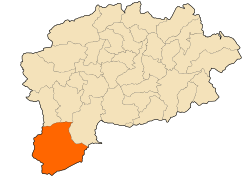
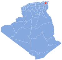
Tamlouka (Arabic: تاملوكة) is a small city of about 22.000 inhabitants in the District of Aïn Makhlouf[1] of the Guelma Province in the northeast of Algeria. It is located at the intersection of W10 and W133, between the cities of Oued Zenati and Aïn Beïda. It is located 60 kilometres from Guelma, capital of the province. Prior to the mass renaming of towns after Algeria's independence, this town was known by the French name Montcalm.[2] Most of the people in the city are Berbers and Chaouis, whose main dialect was one of Berber languages, but know most people know only Arabic.
References
- ^ According to the 2008 census
- ^ "Noms anciens et actuels des villes et villages d'Algérie (Former and current names of towns and villages in Algeria)" (in French). Archived from the original on 28 June 2014. Retrieved 27 December 2008.


