Tulang Bawang Regency
Tulang Bawang Regency
(Kabupaten Tulang Bawang) | |
|---|---|
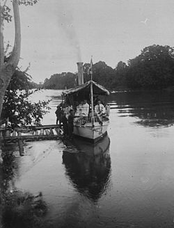
 Tulang Bawang River near Menggala | |
| Motto(s): Sai Bumi Nengah Nyappur (English: one land, friendly getting along) | |
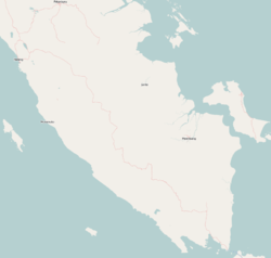
 Location within Lampung | |
| Coordinates: 4°19′04″S 105°30′02″E / 4.3176618°S 105.5005569°E | |
| Country | |
| Province | Lampung |
| Regency seat | Menggala |
| Government | |
| • Regent | Winarti |
| • Vice Regent | Hendriwansyah |
| Area | |
| • Total | 3,466.32 km2 (1,338.35 sq mi) |
| Population (2019)[1] | |
| • Total | 450,902 |
| • Density | 130/km2 (340/sq mi) |
| Human Development Index (2019)[1] | |
| • HDI (2019) | 0.682 Medium |
| Time zone | UTC+7 (IWST) |
| Postcode | 345xx and 346xx |
| Area code | (+62) 736 |
| Vehicle registration | BE |
| Website | tulangbawangkab.go.id |
Tulang Bawang Regency (Lampungnese: ![]() ) is a regency (kabupaten) of Lampung Province, Sumatra, Indonesia. It has an area of 3,466.32 square kilometres (1,338.35 sq mi) and has a population of 450,902 at the 2019 Census.[1] The regency seat is Menggala, located about 120 kilometres (75 mi) from the provincial capital of Bandar Lampung. The regency takes its name from the Tulang Bawang River which flows through the province.
) is a regency (kabupaten) of Lampung Province, Sumatra, Indonesia. It has an area of 3,466.32 square kilometres (1,338.35 sq mi) and has a population of 450,902 at the 2019 Census.[1] The regency seat is Menggala, located about 120 kilometres (75 mi) from the provincial capital of Bandar Lampung. The regency takes its name from the Tulang Bawang River which flows through the province.
Administrative districts
The Regency comprises fifteen districts (kecamatan) which are listed below with their populations at the 2020 Census.[1]
| District | Area (km2) | Population | Population density |
|---|---|---|---|
| Banjar Agung | 230,88 | 42.495 | 186 |
| Banjar Baru | 132,95 | 15.679 | 296 |
| Banjar Margo | 132,95 | 39.465 | 117 |
| Dente Teladas | 685,65 | 53.390 | 77 |
| Gedung Aji | 114,47 | 14.754 | 128 |
| Gedung Aji Baru | 95,36 | 25.339 | 265 |
| Gedung Meneng | 657,07 | 33.265 | 50 |
| Meraksa Aji | 94,71 | 15.820 | 167 |
| Menggala | 344,00 | 50.282 | 145 |
| East Menggala
(Menggala Timur) |
193,53 | 15.480 | 79 |
| Penawar Aji | 104,45 | 20.975 | 200 |
| Penawar Tama | 210,53 | 31.886 | 151 |
| Rawa Pitu | 169,18 | 18.492 | 109 |
| South Rawajitu
(Rawajitu Selatan) |
123,94 | 31.194 | 251 |
| East Rawajitu
(Rawajitu Timur) |
176,75 | 16.856 | 95 |
Economy
Major crops include rice, orange (a growing sector), corn, cassava, soy bean and zallaca palm fruit. As of 2010, the area under plantation in the regency is 298.943 hectares (738.70 acres), mainly rubber, coconut, oil palm and sugar cane.[2] It is particularly known though for its shrimp industry.[2]
References
- ^ a b c d "Kabupaten Tulang Bawang Dalam Angka 2020". www.tulangbawangkab.bps.go.id. Retrieved 7 June 2020.
- ^ a b "Profile of Regency of Tulang Bawang". Indonesia Investment Coordinating Board. Retrieved 22 February 2011.


