Afumați, Ilfov
Appearance
This article needs additional citations for verification. (February 2020) |
Afumați | |
|---|---|
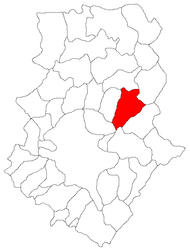
 Location in Ilfov County | |
| Coordinates: 44°31′30″N 26°15′8″E / 44.52500°N 26.25222°E | |
| Country | Romania |
| County | Ilfov |
| Government | |
| • Mayor | Gabriel Dumănică (PNL) |
| Area | 63.25 km2 (24.42 sq mi) |
| Population (2021-12-01)[1] | 8,748 |
| • Density | 140/km2 (360/sq mi) |
| Time zone | EET/EEST (UTC+2/+3) |
| Postal code | 077010 |
| Vehicle reg. | IF |
| Website | www |
Afumați is a commune in the east of Ilfov County, Muntenia, Romania, composed of a single village, Afumați. Its name is derived from the Romanian verb "a afuma", meaning to smoke food.
The ruins of the Princely Court of Radu of Afumați, Voivode of Wallachia from 1522 to 1529, are located at the entrance in the commune, on the left bank of the Pasărea brook.[2]
See also
References
- ^ "Populaţia rezidentă după grupa de vârstă, pe județe și municipii, orașe, comune, la 1 decembrie 2021" (XLS). National Institute of Statistics.
- ^ "Afumați, history and contemporaneity". turisminafumati.ro. Retrieved May 6, 2020.
External links
 Media related to Afumați, Ilfov at Wikimedia Commons


