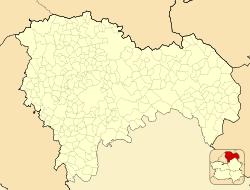
Terzaga
Appearance
Terzaga, Spain | |
|---|---|
 | |
| Coordinates: 40°41′46″N 1°54′08″W / 40.69611°N 1.90222°W | |
| Country | |
| Autonomous community | Castile-La Mancha |
| Province | Guadalajara |
| Municipality | Terzaga |
| Area | |
| • Total | 33 km2 (13 sq mi) |
| Population (2018)[1] | |
| • Total | 22 |
| • Density | 0.67/km2 (1.7/sq mi) |
| Time zone | UTC+1 (CET) |
| • Summer (DST) | UTC+2 (CEST) |
Terzaga is a municipality located in the province of Guadalajara, Castile-La Mancha, Spain. According to the 2017 census (INE), the municipality has a population of 23 inhabitants. It belongs to the Alto Tajo Natural Park and the Geopark of the Comarca Molina-Alto Tajo. It has an area of 33.81 km². From Guadalajara capital it is separated by a distance of 159 km. It is one of the localities through which the route of the Three Taifas of the Camino del Cid takes place.
References
- ^ Municipal Register of Spain 2018. National Statistics Institute.


