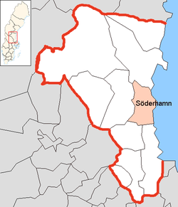
Söderhamn Municipality
Appearance
Söderhamn Municipality
Söderhamns kommun | |
|---|---|
 Railway station in Söderhamn | |
 | |
| Country | Sweden |
| County | Gävleborg County |
| Seat | Söderhamn |
| Area | |
| • Total | 2,281.32 km2 (880.82 sq mi) |
| • Land | 1,060.77 km2 (409.57 sq mi) |
| • Water | 1,220.55 km2 (471.26 sq mi) |
| Area as of 1 January 2014. | |
| Population (31 December 2023)[2] | |
| • Total | 24,858 |
| • Density | 11/km2 (28/sq mi) |
| Time zone | UTC+1 (CET) |
| • Summer (DST) | UTC+2 (CEST) |
| ISO 3166 code | SE |
| Province | Hälsingland |
| Municipal code | 2182 |
| Website | www.soderhamn.se |
Söderhamn Municipality is a municipality in Gävleborg County, in east central Sweden. The seat is located in Söderhamn.
The present municipality was created in 1971 when the former City of Söderhamn was amalgamated with two rural municipalities and parts of a third.
Localities
- Bergvik
- Ljusne
- Marmaskogen
- Marmaverken
- Mohed
- Sandarne
- Skog
- Söderala
- Söderhamn (seat)
- Vallvik
- Vannsätter
International relations
Twin towns — Sister cities
The municipality is twinned with:[3]
 Kunda, Estonia
 Jakobstad, Finland
 Os, Hordaland, Norway
 Szczecinek, Poland
References
- ^ "Statistiska centralbyrån, Kommunarealer den 1 januari 2014" (in Swedish). Statistics Sweden. 2014-01-01. Archived from the original (Microsoft Excel) on 2016-09-27. Retrieved 2014-04-18.
- ^ "Folkmängd och befolkningsförändringar - Kvartal 4, 2023" (in Swedish). Statistics Sweden. February 22, 2024. Retrieved February 22, 2024.
- ^ "Vänorter". soderhamn.se. Retrieved 26 April 2014.
External links
- Söderhamn - Official site

