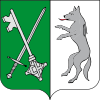
Chotoviny
Appearance
Chotoviny | |
|---|---|
 Chotoviny Castle | |
| Coordinates: 49°28′50″N 14°41′1″E / 49.48056°N 14.68361°E | |
| Country | |
| Region | South Bohemian |
| District | Tábor |
| First mentioned | 1266 |
| Government | |
| • Mayor | Zdeněk Turek |
| Area | |
| • Total | 31.38 km2 (12.12 sq mi) |
| Elevation | 555 m (1,821 ft) |
| Population (2020-01-01[1]) | |
| • Total | 1,765 |
| • Density | 56/km2 (150/sq mi) |
| Time zone | UTC+1 (CET) |
| • Summer (DST) | UTC+2 (CEST) |
| Postal code | 391 37 |
| Website | www |
Chotoviny is a municipality and village in the Tábor District in the South Bohemian Region of the Czech Republic. It has about 1,800 inhabitants.
Administrative parts
- Chotoviny
- Beranova Lhota
- Broučkova Lhota
- Červené Záhoří
- Jeníčkova Lhota
- Liderovice
- Moraveč
- Polánka
- Rzavá
- Řevnov
- Sedlečko
- Vrážná
History
The village of Chotoviny was first mentioned in a document dating from 1266.
Sights
- Chotoviny Castle – historically rich, renovated, and the not-so-distant-future site of destination weddings and retreats
- Church of St. Peter and Paul
- Railway bridge on the road Tábor – Prague
- John of Nepomuk statue in front of Castle
- John of Nepomuk statue near railway station
- Parish house
References
- ^ "Population of Municipalities – 1 January 2020". Czech Statistical Office. 2020-04-30.
Wikimedia Commons has media related to Chotoviny.


