
Mayfield, Georgia
Mayfield, Georgia | |
|---|---|
 Mayfield  Mayfield | |
| Coordinates: 33°21′19″N 82°48′03″W / 33.35528°N 82.80083°W | |
| Country | United States |
| State | Georgia |
| County | Hancock |
| Elevation | 404 ft (123 m) |
| Time zone | UTC-5 (Eastern (EST)) |
| • Summer (DST) | UTC-4 (EDT) |
| GNIS feature ID | 332340 |
Mayfield is an unincorporated community in Hancock County, Georgia, United States on the outskirts of its primary city Sparta.[1]
History
Mayfield was named after the estate of a local judge.[2]
The Shivers-Simpson House, also known as "Rock Mill", south of Mayfield along Mayfield Rd., is listed on the National Register of Historic Places.
References
- ^ a b "Mayfield, Georgia". Geographic Names Information System. United States Geological Survey, United States Department of the Interior. Retrieved July 9, 2015.
- ^ Krakow, Kenneth K. (1975). Georgia Place-Names: Their History and Origins (PDF). Macon, GA: Winship Press. p. 145. ISBN 0-915430-00-2.
Municipalities and communities of Hancock County, Georgia, United States | ||
|---|---|---|
| City | 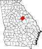 | |
| Unincorporated communities | ||
This Hancock County, Georgia state location article is a stub. You can help Wikipedia by expanding it. |