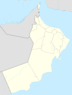
Samail
This article needs additional citations for verification. (January 2017) |
Samail
سَمَائِل | |
|---|---|
Town | |
 Masjid Mazin bin Ghadouba, reportedly Oman's oldest mosque | |
| Coordinates: 23°18′N 57°59′E / 23.300°N 57.983°E | |
| Country | |
| Governorate | Ad Dakhiliyah |
| Time zone | UTC+4 (+4) |
Samāʾil (Arabic: سَمَائِل) is a Wilayah (province) located in Ad-Dakhiliyah Region of the Sultanate of Oman.
Wadi Sama'il

The valley or wadi of Sama'il,[1] also referred to as the "Sumail Gap", divides Al Hajar Mountains into the Eastern and Western subranges. A route from the coast to the country's interior traverses the valley. The gap extends about 60 km (37 miles) from the coast and Muscat Airport on one hand to Sama'il on the other. The route ends at Izki, and acts as the main road from Muscat to Nizwa. The highest point in the gap is above 2,000 ft (610 m) above sea level.[2]
History

Masjid Māzin (Arabic: مَسْجِد مَازِن) is considered to be the oldest mosque in the country. It was founded by Māzin bin Ghaḍūbah (Arabic: مَازِن بِن غَضُوْبَة), who was considered to the first Omani who adopted Islam during Muhammad's lifetime.[2]
Historically, the route along the Sumail Gap was used for trade and communication between coastal and interior areas of Oman. Caravans had used this route for trading in frankincense, and its explorers include Marco Polo and Ibn Battutah.[2]
Climate

| Climate data for Samail (1998-2009) | |||||||||||||
|---|---|---|---|---|---|---|---|---|---|---|---|---|---|
| Month | Jan | Feb | Mar | Apr | May | Jun | Jul | Aug | Sep | Oct | Nov | Dec | Year |
| Mean daily maximum °C (°F) | 25.1 (77.2) |
28.2 (82.8) |
32.5 (90.5) |
37.4 (99.3) |
41.9 (107.4) |
43.5 (110.3) |
42.9 (109.2) |
42.1 (107.8) |
39.8 (103.6) |
36.5 (97.7) |
31.0 (87.8) |
26.8 (80.2) |
35.6 (96.1) |
| Mean daily minimum °C (°F) | 14.7 (58.5) |
16.5 (61.7) |
20.0 (68.0) |
24.4 (75.9) |
29.1 (84.4) |
31.0 (87.8) |
31.4 (88.5) |
30.2 (86.4) |
27.8 (82.0) |
23.8 (74.8) |
19.9 (67.8) |
16.3 (61.3) |
23.8 (74.8) |
| Average precipitation mm (inches) | 5.4 (0.21) |
8.4 (0.33) |
19.3 (0.76) |
6.2 (0.24) |
0.7 (0.03) |
11.7 (0.46) |
3.5 (0.14) |
3.5 (0.14) |
1.7 (0.07) |
2.0 (0.08) |
10.1 (0.40) |
9.3 (0.37) |
81.8 (3.23) |
| Source: World Meteorological Organization (temperature and rainfall 1998–2009)[3] | |||||||||||||
References
- ^ Cavendish, Marshall (2007). World and Its Peoples. Vol. 1. Cavendish Square Publishing. p. 11. ISBN 978-0-7614-7571-2.
- ^ a b c Darke, Diane (2010). Oman: The Brad Travel Guide. Bradt Travel Guides. ISBN 9781841623320. Retrieved 15 March 2015.
- ^ "Climatological Information - Samail". World Meteorological Organization. Retrieved 28 March 2016.

