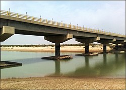
Mond River
| Mond River | |
|---|---|
 | |
| Native name | رودخانه مند Error {{native name checker}}: parameter value is malformed (help) |
| Physical characteristics | |
| Source | |
| • location | Fars Province, west of Shiraz |
| • coordinates | 29°49′28″N 51°51′38″E / 29.82444°N 51.86056°E |
| Mouth | |
• location | Persian Gulf, in Bushehr Province |
• coordinates | 28°8′16″N 51°16′11″E / 28.13778°N 51.26972°E |
The Mond River (Persian: رودخانه مند), also known in English as the Mand River, runs through Fars Province and Bushehr Province in south-western Iran, flowing to the Persian Gulf.[1][2]
See also
References
- ^ Moqimi, Mahmood (2004), Mond protected area, Bushehr, Iran, p. 57
{{citation}}: CS1 maint: location missing publisher (link) - ^ Mostafavi, Hossein (2008), Biodiversity of Mond Protected Area, Tehran, Iran: Shahid Beheshti University, pp. 252–3
